South City Park
Buildings south of the park were documented in Denver's City Park neighborhood. documented.
Check back for the full South City Park survey report!
Wellshire
Denver's Wellshire neighborhood is located in the southeaster part of the city. Buildings in Wellshire south of Dartmouth were documented.
Check back for the full Wellshire survey report!
Sunnyside
The Sunnyside neighborhood is in northwest Denver, bounded by Federal Boulevard (west), Inca Street (east), I-70 (north), and W. 38th Avenue (south). About 3,400 buildings are being documented in Sunnyside.
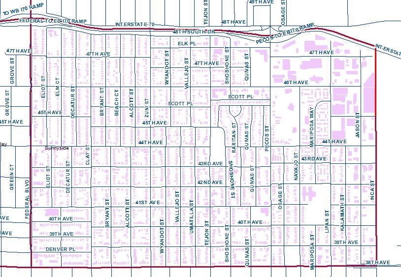
Check back for the full Sunnyside survey report!
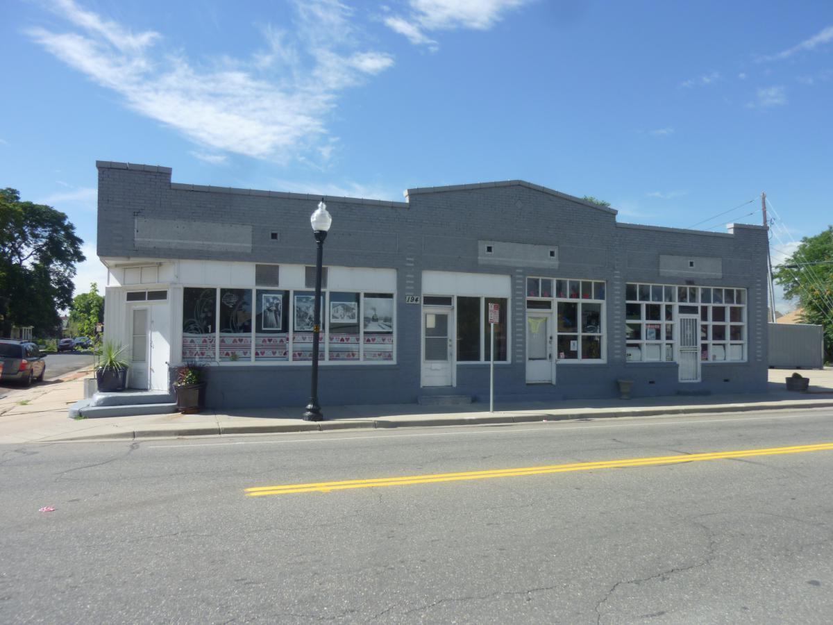
Streetcar Commercial Districts
Discover Denver surveyed buildings in three of the city's former streetcar commercial districts. Buildings were documented along parts of South Pearl Street, South Gaylord Street, and Tennyson Street.
Check back for the full survey report of the streetcar commercial districts!
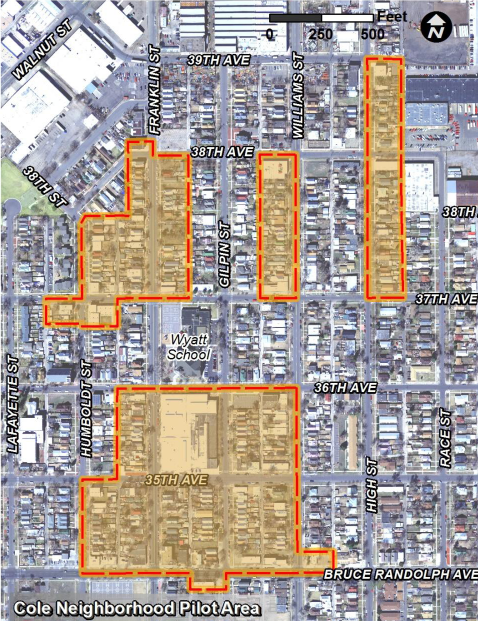
Cole
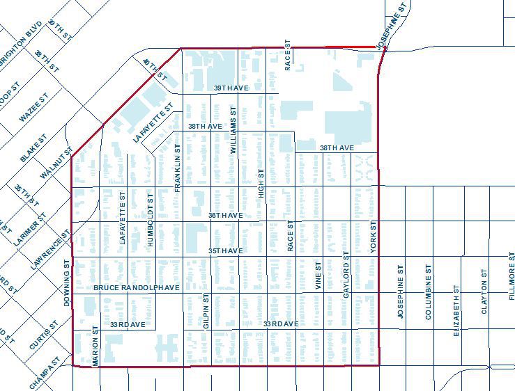
The Cole survey area consisted of buildings within the Cole statistical neighborhood, bounded by Downing Street (west), Walnut Street (northwest), E. 40th Avenue (north), York Street (east), and Martin Luther King Boulevard (south). The boundaries for the survey area are shown on the map below.
Check back for the full survey report of the Cole survey area!
Regis
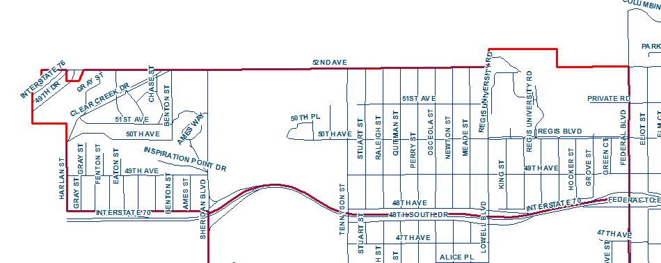
The Regis neighborhood is bordered by W. 52nd Avenue (north), Federal Boulevard (east), East 6th Avenue (I-70) and Harlan Street (west). There are approximately 1,600 primary buildings in the neighborhood, including residential and commercial structures.
Check back for the full survey report of the Regis survey area!
West Colfax
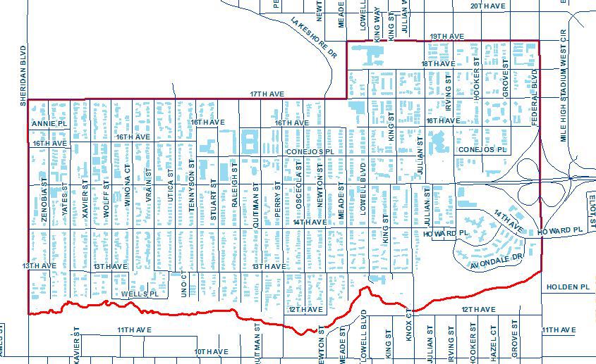
The survey area is bordered by W. 19th Avenue (north), Federal Boulevard (east), Lakewood Gulch (south) and Sheridan Boulevard (west). There are approximately 1,700 primary buildings in the neighborhood, including residential and commercial structures.
Check back for the full survey report of the West Colfax survey area!
Congress Park
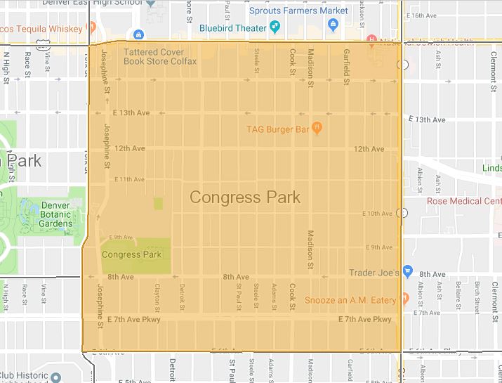
The survey area is bordered by Colfax Avenue (north), Colorado Boulevard (east), East 6th Avenue (south) and York Street (west). There are approximately 2,400 primary buildings in the neighborhood, including residential and commercial structures.
Check back for the full survey report of the Congress Park survey area!
West Capitol Hill - East Cheesman
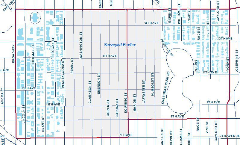
The survey area is made up of the western part of the Capitol Hill neighborhood and the eastern part of the Cheesman Park neighborhood. There are approximately 260 primary buildings in the combined areas, including residential and commercial structures.
Check back for the full survey report of the West Capitol Hill-East Cheesman survey area!
Capitol Hill - West Cheesman
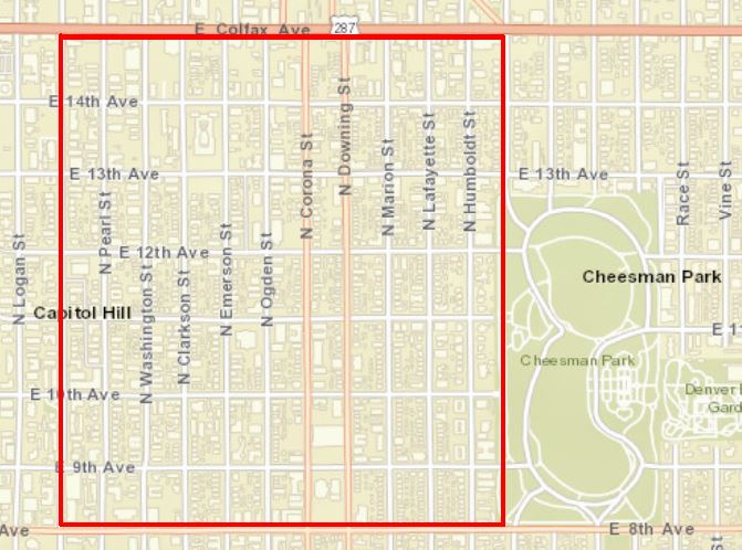
The survey area is bordered by Colfax Avenue (north), Franklin Street (east), East 8th Avenue (south) and Pennsylvania Street (west). There are approximately 1,000 primary buildings in the neighborhood, including residential and commercial structures.
Check out the survey report under the Discoveries tab in the main menu.
City Park West Neighborhood
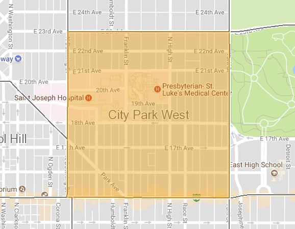
The City Park West neighborhood is bordered by East 23rd Avenue (north), York Street (east), Colfax Avenue (south), and Downing Street (west). Approximately 1,100 primary buildings were surveyed in City Park West, including residential and commercial structures.
The neighborhood contains an eclectic collection of buildings dating from the late 1870s.
Check out the survey report under the Discoveries tab in the main menu.
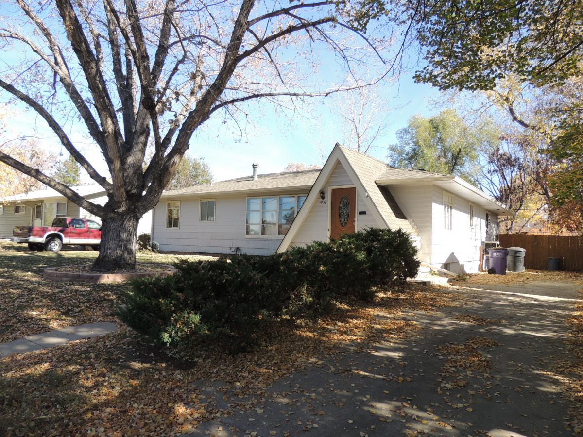
Virginia Village Neighborhood
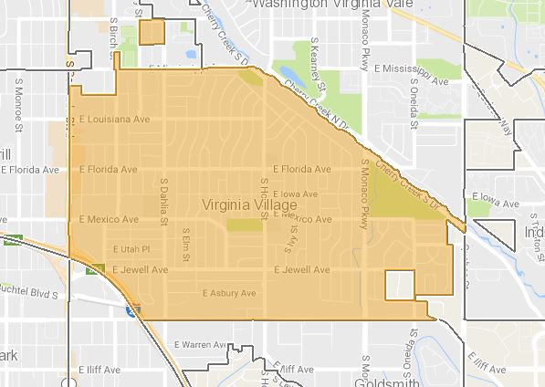
Virginia Village is bordered by Mississippi Avenue (north), Cherry Creek South Drive (northeast), Quebec Boulevard (east), Evans Boulevard (south), I-25 (southwest) and Colorado Boulevard (west). There are approximately 3,700 primary buildings in the neighborhood, counting both residential and commercial structures.
This was a largely agricultural area in unincorporated Arapahoe County before its annexation by Denver in 1954. Before widespread residential development began here in the mid-1950s, the area was home to greenhouses growing prized Colorado carnations and stables from which riders on horseback followed bridle paths that snaked through the neighborhood.
Check out the survey report under the Discoveries tab in the main menu.
Click the thumbnail below to see images of the Virginia Village neighborhood:
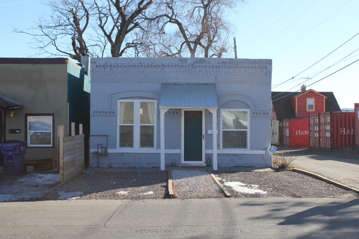
Elyria Swansea Neighborhood
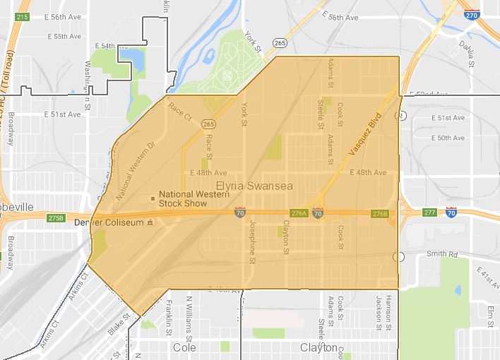
The Elyria Swansea neighborhood originated as two neighboring independent communities, Elyria and Swansea. These communities were established in the late 19th century near Denver’s railroad lines, smelters, meat packing houses and stock yards. Swansea was founded in 1870, while Elyria was platted in 1881 and incorporated in 1890. Both communities were annexed by the city of Denver in 1902. The original town of Elyria was located west of today’s York Street, and Swansea east of York.
Early residents of Elyria and Swansea were primarily European immigrants who walked to their jobs at the nearby railroads, packing houses and smelters. Located amid these communities were small farms and dairies. Early in the 20th century, new industrial companies were established on the outskirts of the neighborhood, taking advantage of the nearby railroads. After World War II, many of the small farms were replaced by tracts of affordable housing built for returning servicemen. The complexion of this once compact neighborhood changed in the early 1960s, when I-70 was built through the area, bisecting it into north and south sections.
Click here to view the survey report for Elyria Swansea.
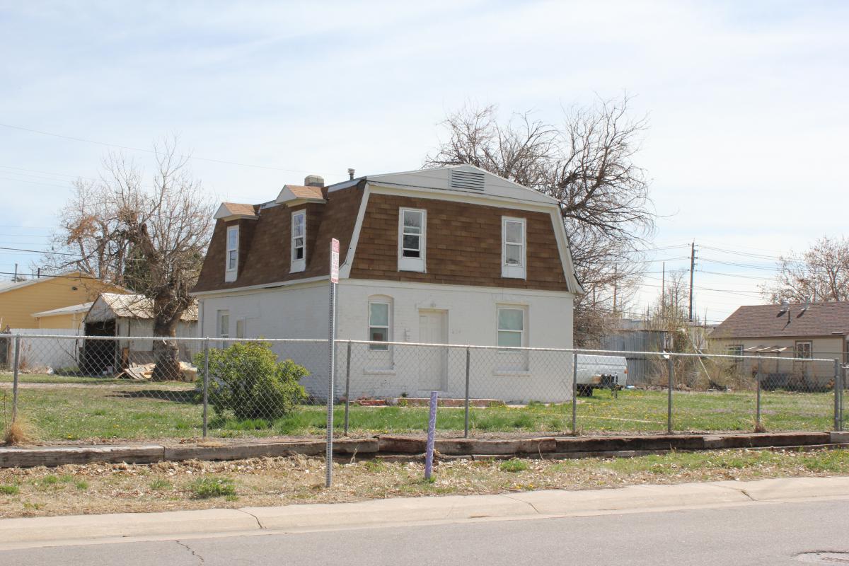
Click the thumbnail below to see images of the Elyria Swansea neighborhood:
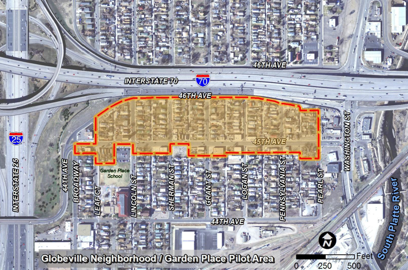
Globeville
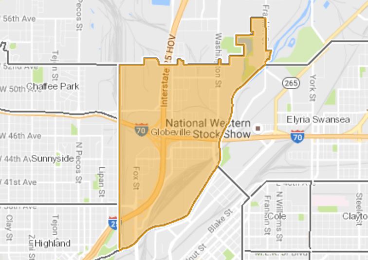
Like many of the city’s neighborhoods, Globeville started out as an independent community, separate from Denver. Located just north of Denver, Globeville was established around 1889 and formally incorporated in 1891. Globeville residents were primarily European immigrants from central and eastern European countries that came to the United States to escape political and economic depression at home. Immigrant groups in Globeville included Poles, Slovenians, Croatians, Serbs, Russians, Slovaks, Czech, and German-speaking Russians from along the Volga River. Most residents worked for the nearby smelters, railroads and packing houses. Globeville refused several offers of annexation by Denver before relenting in 1902, based on offers of improved water service, lower taxes, and the construction of a streetcar line. It took many years for these improvements to materialize.
In the beginning, a large percentage of Globeville's residents were immigrants who left their families back in their home countries while they found work and established a new home. These single men were housed in company-owned hotels and boarding houses, where the costs of their room and board were deducted from their paychecks. Between 1893 and 1907 the families of these workers immigrated to Colorado, resulting in the population of Globeville nearly doubling. This population explosion resulted in Globeville having some of the greatest ethnic diversity found in Denver. For many decades, Globeville remained a niche neighborhood where the commercial, social and religious needs of the residents were met in a small geographic area. It remained a close-knit community, with ethnic minorities who lived, worked, and worshiped with others who shared similar life experiences. Even today, a century later, concentrations of related families can be found throughout the neighborhood.
Click here to view the survey report for Globeville.
Click the thumbnail below to see images of the Globeville neighborhood:
Jefferson Park
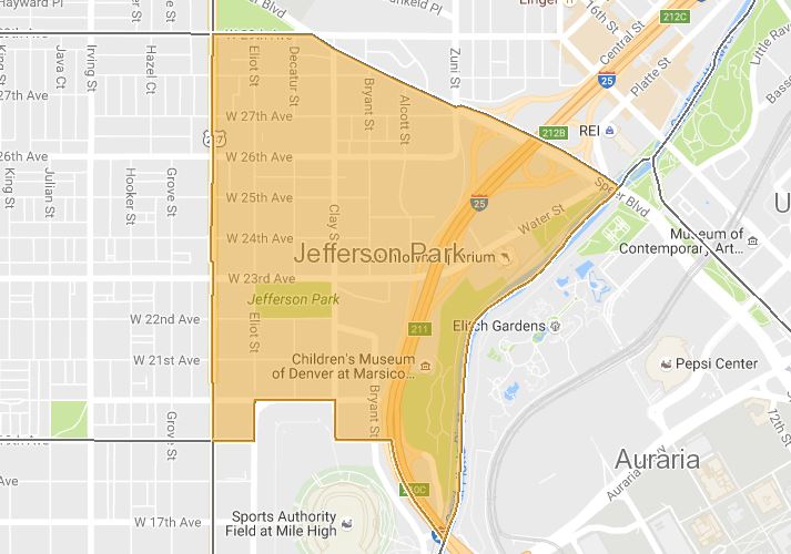
Jefferson Park is one of the oldest neighborhoods in Denver, with buildings dating to the 1880s. It takes its name from the large five-acre park, a former city dump, located at the southeast corner of West 23rd Avenue and Clay Street in the heart of the neighborhood. Jefferson Park includes parts of the original Congressional Grant of 1860 and part of the incorporated Town of Highlands. The Town of Highlands was founded in 1871 and incorporated in 1875, before being annexed by Denver in 1896. Jefferson Park is part of a larger area that was commonly known as “North Denver” after the annexation of the Town of Highlands. Subdivisions within Jefferson Park date to as early as 1871.
Located across from Denver on the west side of the Platte River, the Town of Highlands looked down on its larger neighbor, both literally and figuratively. Highlands was intended to be an elite suburb where businessmen working in Denver resided above and away from the smog, corruption and congestion of the big city. Clean living was encouraged, and residents touted their artesian wells, pure air and lack of drinking establishments. One of the earliest streetcar lines in Denver, built in 1872, ran along Emerald Avenue (today’s West 25th Avenue), connecting the suburb to downtown Denver.
While many residents of Highlands commuted across the river to jobs in Denver, others were employed by businesses within the town boundaries. The Rocky Mountain Brewery, located on the eastern edge of today’s Jefferson Park, was founded in 1859 by John Good. Philip Zang joined the brewery in 1869, eventually purchasing it from Good and renaming it the Zang Brewery. City directories and census records show that many early area residents were employed by the brewery. The Old Homestead Bakery, formerly located at the northeast corner of today’s West 27th Avenue and Decatur Street, was another well-known area business. Founded in 1902 by William J. Meikleham, the bakery employed seventy workers and shipped its goods as far away as Wyoming, Nebraska, Kansas and New Mexico. Meikleham and his family lived next to the bakery in a substantial eclectic home that still stands at the northwest corner of West 27th Avenue and Clay Street.
A commercial district serving the needs of the neighborhood developed along the West 25th Avenue streetcar line between Eliot Street and Federal Boulevard. Development of the district began in the late 1890s and continued through the 1920s. The district, anchored by mixed-use two-story brick buildings with corner entrances and display windows, also contains a movie theater. Other small turn-of-the-century commercial buildings were located on street corners throughout the neighborhood, providing goods and services to nearby residents. A good example of an early corner grocery still stands at the southeast corner of West 26th Avenue and Decatur Street.
While most homes within Jefferson Park were fairly modest and middle-class, grander homes were built along the edges of the neighborhood. Federal Boulevard, located at Jefferson Park’s western edge, was formerly known simply as “The Boulevard” and later “Boulevard F.” In the late 19th century, Federal was lined with the stately residences of doctors and successful businessmen. On the eastern edge of Jefferson Park, the estate of General Roger Woodbury took up several city blocks. Located at West 25th Avenue and Alcott Street, Woodbury’s mansion was demolished in the early 1970s to make way for the Diamond Hill office complex.
After World War II, the population of the neighborhood steadily declined. Single family residences were razed during this period to make way for office and commercial uses, as well as for new low-rise apartment blocks. Homes at the southern edge of the neighborhood were demolished to make way for expanded parking for Mile High Stadium.
Presently, Jefferson Park is undergoing a dramatic transformation. A booming economy and a close proximity to downtown have made Jefferson Park an attractive area for new development. Much like in the post-war period, single family homes are being razed to make way for increased density.
Click here to view the survey report for Jefferson Park.
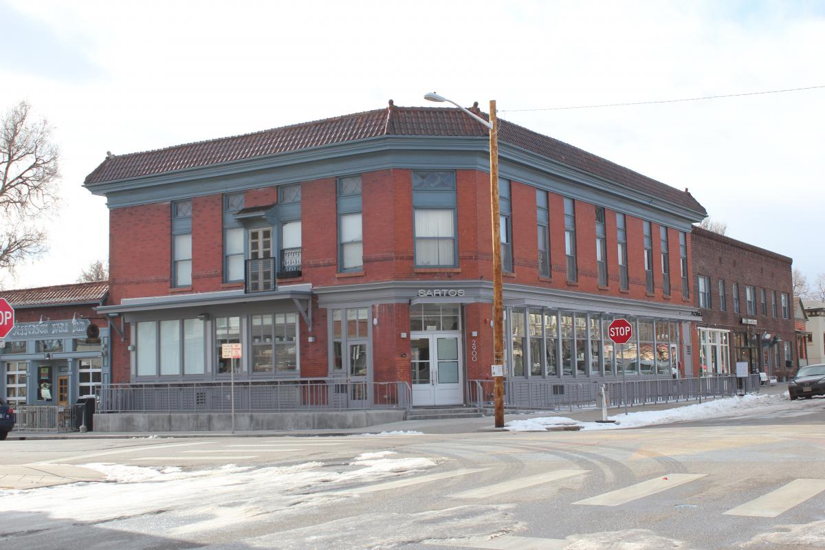
Click the thumbnail below to see images of the Jefferson Park neighborhood:
Pilot Area #3 - Streetcar Commercial Districts
Denver’s streetcar system began just twelve years after the founding of the city and physically shaped Denver as we know it today. Denver’s streetcar system once spanned the width and breadth of Denver — and beyond — and had such an impact on Denver’s built environment that we still can see evidence of this system throughout the city today. Tucked into nearly every Denver neighborhood are embedded commercial districts which function as hubs of local, independent business activity.
For its third pilot project, Discover Denver surveyed the buildings in two of these streetcar commercial districts -- one in the Globeville neighborhood, and the other in the Cole neighborhood.
Click the thumbnail below to see images of the streetcar commercial district survey areas:
Click here to view the survey report for Pilot Area #3.
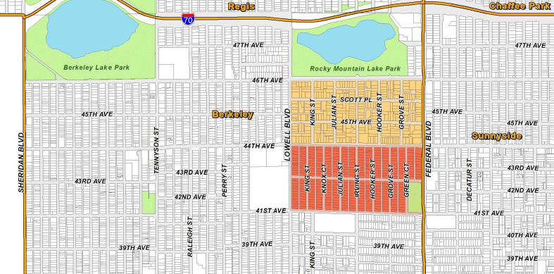
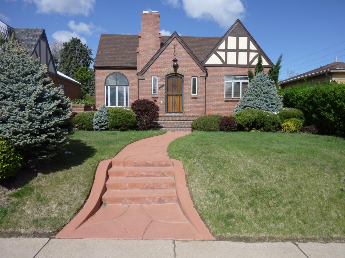
Pilot Area #2 - 1920s Small Homes
As initially conceptualized, Pilot Area #2 focused on homes built using plans developed by the Architect's Small House Service Bureau (ASHSB). The ASHSB, created in 1914 by a group of Minnesota architects, had its roots in the City Beautiful movement and produced plan books containing architect-designed plan sets for small houses. The Mountain Division of the ASHSB was established in Denver in 1921, and it is believed that many homes were built in the Denver area in the coming decades using ASHSB plans. As planning for this Discover Denver pilot survey area progressed, it became clear that it would be very difficult to identify homes built using ASHSB plans. For this reason, Pilot Area #2 was broadened to focus on small homes, defined for this project as those under 2,600 square feet built during the 1920s in Denver.
The subdivisions of Harkness Heights and Grand View in the Berkeley neighborhood and a section of the Park Hill neighborhood were selected for survey during this pilot.
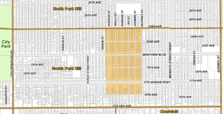
Click the thumbnail below to see images of the Pilot #2 survey areas:
Click here to view the survey report for Pilot Area #2.
Pilot Area #1 - Harvey Park
The land that is now Harvey Park was originally 160 acres of ranch land known as “Whiteman’s Black and White Ranch." The ranch was owned by Paul Whiteman, a well-known jazz musician in the 1920s and 1930s. The ranch was sold twice before being purchased by Arthur “Tex” Harvey, a successful oilman. Harvey sold the land to Aksel Nielsen of Mortgage Investments Company following World War II for $30 million. Nielsen's company planned a 1,662 home subdivision, to be called Harvey Park.
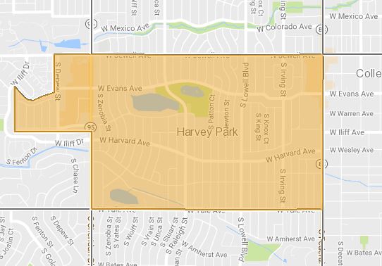
Click the thumbnail below to see images of the Harvey Park neighborhood.
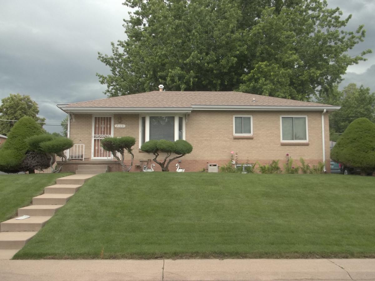
Click here to view the survey report for Pilot Area #1.